

Our key products
If you are searching for GNSS-free positioning, geo-referencing and AI-aided analytics, ProTrack has the best software on the global market.
FLIGHT
Our leading Geo-Positioning (Geo-Reference) software for airborne surveillance:
-
Detects and identifies user-defined stationary and moving targets/objects in video, displays their positions on a map and sends their location data to 3rd party systems.
-
Real-world coordinates extraction from real-time and offline video (day and night).
-
Ultra fast, in-mission ortho-mosaic (aerial map) creation.
-
seamlessly integrates with your existing C5I systems.


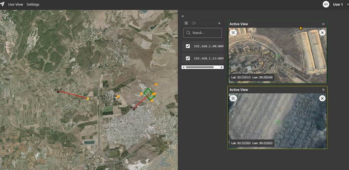
Map
Video
RED = position based on spoofed GPS
YELLOW = fixed position with Locator
LOCATOR
Our premier, industry-leading GNSS-free positioning software. Proven in the field, LOCATOR tests GPS and INS telemetry in real-time and corrects its accuracy. It provides the accurate position when GPS or INS signals are corrupted, non-existent or severely drifted.
LOCATOR can be installed on off-the-shelf Linux or Windows SOMs and is easily integrated with the platform's controller.

Specialized Analytics
Our special-purpose AI-based Analytics is used for a variety of purposes, including:
-
Moving/stationary target/object detection, classification and tracking
-
Event detection (smoke, fire, leaks, etc.)
-
Change detection
-
High-level feature extraction for image matching
-
Similar image retrieval based on query images
OMNIUM
A system-wide, scalable Command and Control application for Terrain Dominance and Wide Area Situational Awareness
Omnium website: www.omnium-c2.com
Our additional products


.png)
Foresight, WideEye and SeeOn
also provide:
-
Video motion detection for PTZ sensors
-
Automatic path scanning
-
Real-time object and target tracking
-
Classification and analytics
-
Region of interest definition